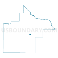
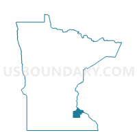
Goodhue Voting District, Goodhue County, Minnesota
About
Outline

Summary
| Unique Area Identifier | 602016 |
| Name | Goodhue Voting District |
| County | Goodhue County |
| State | Minnesota |
| Area (square miles) | 0.94 |
| Land Area (square miles) | 0.94 |
| Water Area (square miles) | 0.00 |
| % of Land Area | 100.00 |
| % of Water Area | 0.00 |
| Latitude of the Internal Point | 44.40050240 |
| Longtitude of the Internal Point | -92.62560520 |
Maps

Graphs
Select a template below for downloading or customizing gragh for Goodhue Voting District, Goodhue County, Minnesota